Lorenzo Maria Pacini
The SCO could evolve from a security organization into one of the institutional frameworks of a truly interconnected Eurasian economic and strategic space.
The new geography of railways
When analysts discuss the Shanghai Cooperation Organization, they tend to focus on security issues: counterterrorism, military coordination, and anti-hegemonic rhetoric. This is a partial interpretation. The most significant game currently being played within the SCO does not involve armies, but railroads. Over the past two years, the Organization has taken on a role that none of its founding documents had explicitly assigned to it: that of a coordination platform for a network of transport corridors that is redrawing the economic geography of Eurasia.
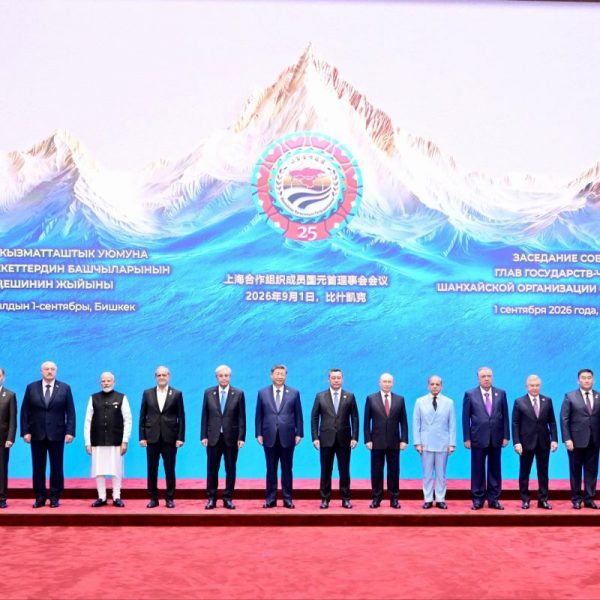
It is worth clearing up a widespread misunderstanding right away. The SCO is not building an "SCO corridor." There is not, and probably never will be, a single artery bearing that name. What is emerging is something different and, strategically speaking, more interesting: an institutional framework in which multiple overlapping corridors - some running east-west, others north-south - are gradually being aligned, standardized, and connected. The Tianjin Declaration of September 1, 2025, sets this out in black and white, calling for the creation and modernization of international transport routes, with explicit mention of the North-South and East-West corridors, the digitization of logistics, and the strengthening of supply chains. This is not an isolated announcement but rather part of a series of documents dating back at least to the 2014 Dushanbe Agreement and the 2022 Samarkand Concept.
The first major axis runs, in general terms, from China through Central Asia, Russia, and the Caspian region, ultimately extending toward Europe and the Middle East. The project that is redefining its structure is the China-Kyrgyzstan-Uzbekistan (CKU) railway. Discussed for over a quarter of a century - the first trilateral memorandum dates back to 1997 - the line has long been held hostage by disputes over the route, financing, and track gauge. The turning point came between 2024 and 2025: the intergovernmental agreement signed in Beijing in June 2024, the groundbreaking ceremony on December 27 of that same year, and the finalization of the financial framework - approximately $4.7 billion - in December 2025.
The numbers explain why the project matters. According to the Kyrgyz transport minister, the line is expected to shorten the route from East Asia to Iran, Turkey, and Europe by about 900 kilometers, with an estimated reduction in transit time of seven to eight days. Sources differ on capacity, and this discrepancy deserves to be highlighted rather than glossed over: the International Railway Journal cites up to 12 million metric tons annually, while other analysts estimate 13-15 million metric tons at full capacity, starting from a conservative initial threshold of 5-8 million metric tons. This range reflects the uncertainty inherent in an infrastructure project still under construction, not a confirmed figure.
However, it would be a mistake to view the CKU as "just another railroad." China already has multiple routes to the west, starting with the well-established corridor through Kazakhstan. The value of the CKU lies elsewhere: it opens up a new central-southern route that crosses Kyrgyzstan and Uzbekistan and, from Uzbekistan, can then branch out toward Turkmenistan, Iran, Turkey, the Caspian Sea, the Caucasus, Europe, and the Middle East. The route, just over five hundred kilometers long, includes about three hundred kilometers through the Kyrgyz Tien Shan mountains and requires a transshipment station in Makmal, where the cargo is transferred from the Chinese track gauge of 1,435 millimeters to the Central Asian gauge of 1,520. This technical detail is no minor engineering matter: it is the first indication of a problem - interoperability - to which we will return, because that is what determines whether a corridor truly functions.
Central Asia is truly becoming central
Looking at the map, Uzbekistan is poised to become one of the main logistics hubs of the entire SCO region. Its location, at the heart of Central Asia, allows it to connect with multiple routes simultaneously. From China through Kyrgyzstan; southward, toward Turkmenistan and Iran all the way to Turkey; further south, through Afghanistan and Pakistan, with access to the Indian Ocean; or northward, along the Kazakh route toward Russia. Tashkent has grasped the logic of this geography and has begun to present itself not merely as a Central Asian country, but as a transit state - a distinction that carries significant weight in geopolitical terms.
The strategy is clear: to integrate the CKU route with existing international networks, including connections to Iran and Turkey. According to data attributed to the Uzbek Ministry of Transport, freight traffic with SCO member countries could reach truly significant levels, in line with a major ambition: to make Uzbekistan one of the connecting hubs between the organization's eastern, central, and southern components.
The potentially most promising corridor - especially from India's perspective - runs from China through Kyrgyzstan and Uzbekistan toward Afghanistan, Pakistan, and then India, with access to the Indian Ocean. The missing link is the Uzbekistan-Afghanistan-Pakistan (UAP) railway, which is still in the feasibility study phase. On July 17, 2025, the three countries signed an intergovernmental framework agreement in Kabul to jointly conduct a feasibility study on the Termez-Kharlachi section; Uzbekistan ratified it by presidential decree on February 4, 2026, and the active phase of field surveys is now underway. The planned route - approximately 573 kilometers through Termez, Mazar-i-Sharif, Logar, and the Kharlachi Pass - is estimated to cost about $4.8 billion, with a design capacity of up to twenty million metric tons per year.
If the UAP were one day to be linked to the CKU, the result would not be a mere sum of segments, but a leap in scale: a continuous land corridor stretching from China, through Central Asia and Afghanistan, all the way to South Asia and the Indian Ocean. It is here that India ceases to be merely the terminal of the corridor and becomes something more: one of the main maritime outlets of the Eurasian continental system. At this point, the continental geography of the SCO begins to intersect with the oceanic geography of the Indo-Pacific. However, some qualification is in order: the UAP remains a project on paper, and Afghanistan demonstrates just how vulnerable land-based infrastructure can be to instability. The hypothesis is plausible; its realization is by no means certain.
The second major axis follows a mirror-image logic. It connects Russia, via the Caspian Sea and Iran, to the Indian Ocean and India. This is the International North-South Transport Corridor (INSTC), conceived in 2000 by Russia, Iran, and India as a multimodal system - sea, rail, and road - spanning approximately 7,200 kilometers that links Russian ports to the Gulf and the Indian Ocean. Its function is to connect Russia's North Eurasian space with India's maritime economy, offering an alternative to the long route via the Suez Canal.
The INSTC, too, has its unfinished links. The Rasht-Astara rail segment, on the border between Azerbaijan and Iran, remains the missing link, and sanctions against Iran and Russia complicate financing and transactions. But the resulting network is what matters. The SCO has the potential to connect Russia to India through Central Asia and Iran, while other corridors link China to Europe and the Middle East through Central Asia and Iran, and still others connect China to the Indian Ocean through South Asia. The result is not a single corridor. It is a network of corridors. And the difference is entirely strategic.
Redundancy as a strategic objective
This is where the geopolitical interpretation becomes more complex. The purpose of these corridors is not merely to make transportation faster; it is to create redundancy. The term, borrowed from systems engineering, refers to the availability of multiple alternative routes rather than reliance on a single artery. Consider the map of the world's maritime bottlenecks: Suez, Bab el-Mandeb, the Strait of Hormuz, and the Strait of Malacca. A disruption at just one of these points can ripple through global trade.
Land corridors cannot replace maritime transport on a global scale - the capacity of a container ship remains incomparable to that of a rail convoy. But they can offer alternative channels for certain categories of strategic goods and raw materials. In this sense, the development of Eurasian railways and highways is also a form of strategic resilience. The formula that sums up the goal of the emerging system is essential: more routes, more suppliers, more markets, more modes of transport. It is the logistical foundation of strategic autonomy, and it is worth stating plainly, because it is precisely what distinguishes a robust network from a vulnerable one.
The reason this architecture makes sense right now lies in the vulnerability of maritime trade. A world dependent on a few straits is exposed to wars, sanctions, blockades, piracy, regional instability, geopolitical competition, and disruptions to navigation. Land corridors offer a different architecture. They are not immune to geopolitical risk - Afghanistan serves as an eloquent reminder of this - but they diversify the available routes. The lessons of recent years, from the attacks in the Red Sea to the tensions around Hormuz, have made this line of reasoning less theoretical than it was a decade ago.
Some infrastructure limitations
This is where the greatest obstacle lies. Tracks can be laid, but if trains must stop at every border because documentation, customs procedures, technical standards, and track gauges are incompatible, the corridor remains inefficient. This is why the SCO's focus is shifting from construction to logistical harmonization. The Tianjin Declaration itself links the development of the corridors to the digitization of procedures, the electronic exchange of cargo data, and technical harmonization; and this framework has been consolidated through a series of sector-specific summits - railway officials in Moscow in November 2024, transportation ministers in Tianjin in July 2025, and port and logistics center officials in Aktau. Whether this convergence will take the form of a permanent body dedicated to the integration of rail networks - with a mandate covering track gauges, technical standards, rolling stock, and border procedures - is a plausible direction rather than an already institutionalized reality.
The most useful way to frame the issue is as follows: the actual corridor is not the railroad itself. It is the railroad plus customs, plus digital documentation, plus standards, plus ports, plus logistics centers. The next phase of Eurasian connectivity will not consist solely of building infrastructure, but of creating interoperability - a much more sophisticated conception of connectivity than that suggested by the mere inauguration of new lines.
An often-overlooked aspect is that the Eurasian corridor of the future will be both physical and digital. The physical layer consists of railroads, highways, logistics hubs, dry ports, seaports, and pipelines. The digital layer consists of customs systems, electronic documentation, cargo tracking, data exchange, digital payments, and supply chain management. This distinction is not merely cosmetic: control over logistics increasingly coincides with control over information flows, as well as physical ones. Whoever controls transit data increasingly controls the transit itself.
These corridors should not be interpreted as if China, Russia, and India were pursuing identical objectives. This is not the case, and it is precisely this divergence that makes the picture interesting. China seeks market access, secure supply chains, connectivity with the West, and reduced dependence on maritime straits. Russia seeks alternative routes to Asian markets, greater use of Eurasian land routes, and connectivity with India, Iran, and China. India seeks access to Central Asia and Russia, alternative Eurasian connectivity, and a reduction in its dependence on routes controlled by China or Pakistan.
Each power, therefore, supports connectivity for its own reasons, some of which are even conflicting - consider the Sino-Indian rivalry or New Delhi's distrust of corridors passing through Pakistan. This is where the SCO demonstrates its unique function: it builds an institutional framework within which different strategic interests can converge without having to become identical. It is not an alliance in the classical sense; it is a variable-geometry coordination mechanism, and its stability depends precisely on its ability to avoid demanding homogeneity.
Will the maps change?
If these projects come to fruition - a necessary condition - the traditional map of Eurasia will change. Historically, the major global trade system has been predominantly maritime: East Asia, the Indian Ocean, the Suez Canal, and Europe. The emerging Eurasian system adds a second dimension: East Asia, Central Asia, Russia, Iran, the Middle East, South Asia, and from there to Europe and the Indian Ocean. It does not replace maritime trade; it complements it. The future system will, in all likelihood, be multimodal: rail plus road plus pipelines plus maritime transport plus digital logistics.
The conclusion can be stated as follows. The SCO is not building a single Eurasian corridor; it is helping to create a network of interconnected corridors. The China-Kyrgyzstan-Uzbekistan railway, the potential Uzbekistan-Afghanistan-Pakistan connection, the North-South corridor linking Russia to India via Iran, and the various East-West routes - - together form a new geography of connectivity. What matters, strategically speaking, is not the infrastructure itself, but the redundancy it creates: Eurasian states are securing alternative routes to markets, energy supplies, and strategic partners, thereby reducing their dependence on individual maritime straits and on transportation systems controlled by a single power. The next phase will focus on interoperability - rail gauges, customs procedures, digital documentation, logistics, and standards.
If these elements are integrated, the SCO could evolve from a security organization into one of the institutional frameworks of a truly interconnected Eurasian economic and strategic space.